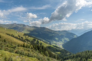
Explore the Tux valley from its most beautiful side
Situated higher than the rest of the Zillertal valley, the Tuxertal valley is the perfect starting point for spectacular summer hikes. Tux-Finkenberg’s magnificent natural landscape boasts more than 350 km of hiking trails, each with a character of its very own. There are easy, leisurely walks, higher situated mountain trails to romantic inns and huts as well as high alpine paths passing by crystal-clear mountain lakes, and across fragrant flower meadows or through old mountain forests.
Hikes in mountain pastures and huts

Start: mountain station Finkenberger Almbahnen II. section/Penkenjoch
End: Tux-Vorderlanersbach
- Difficulty: medium
- Route length: 12,7 km
- Walking time: 4,5 h
- Vertical meters uphill: 240 m
- Vertical meters downhill: 1060 m
- Highest point: 2260 m
- One Way Hike
- Stamp station
- Cable car
Tour description: After the mountain station Penkenjoch (2095 m) keep left and hike on trail 57. At the Wanglalm take the short ascent to the Wanglspitze and then turn left onto trail 55. First take a leisurely walk along the „Wanglseite“, past the reservoir, until trail 51 continues to the Lämmerbichl mountain restaurant. From the mountain restaurant, follow the wide alpine path over the „Anger“ to the mountain road that leads to the Geislerhof. Walk out of the valley on the road via the hamlet of Schöneben to Tux-Vorderlanersbach.
TIP: Architecture on the sunny plateau: the Garnet Chapel on the Penkenjoch.

Start: Tux-Lanersbach
End: Tux-Lanersbach
- Difficulty: medium
- Route length: 18 km
- Walking time: 7 h
- Vertical meters uphill: 920 m
- Vertical meters downhill: 920 m
- Highest point: 2135 m
- Circular hiking trail
- Stamp station
Tour description: At the valley station of the Eggalm Bahnen path 21 to the hamlet of Gemais, via AV path 321 to Voglaue and uphill to the Nasse Tuxalm. Via the Nederjoch to the Vallruckalm (highest alpine pasture in Tyrol at 2132 m!) on hiking trail 47 and over the graveled alpine pasture path to the Hobalm. Continue on the mountain road past the Geiselalm, over the bridge to the Geislerhof mountain inn. Descent options: AV path 315 and 321 and 21 via Gemais to Tux-Lanersbach/Tux-Vorderlanersbach or down the mountain road passing the hamlet „Schöneben“ to Tux-Vorderlanersbach.
- TIP: Shortening of the tour by 2 h when using the hiking taxi!

Start: Tux-Lanersbach
End: Tux-Lanersbach
- Difficulty: medium
- Route length: 5,5 km
- Walking time: 3 h
- Vertical meters uphill: 460 m
- Meters of altitude downhill: 460 m
- Highest point: 1739 m
- Circular hiking trail
- Stamp station
Tour description: Above the Eggalm valley station the signpost shows us the mountain path towards Gemais out of the valley. After the „Rosenkranzkapelle“ chapel, we follow the forest path until the turnoff to the left uphill to the Lattenalm, path 33. After the rustic hut, we continue hiking on the wide alpine path 39 to the Eggalm-Niederleger. There we take the partly steep mountain trail 23 downhill to Tux-Lanersbach.
TIP: Trail no. 23 is crossed by flatter forest trails and a branch-off.

Start: Tux-Lanersbach
End: Tux-Lanersbach
- Difficulty: medium
- Route length: 6 km
- Walking time: 2,5 h
- Vertical meters uphill: 330 m
- Meters of altitude downhill: 330 m
- Highest point: 1622 m
- Circular hiking trail
- Stamp station
Tour description: Make your way past the hotel Jäger (house 480), following path 21 over the stream and then along the road to the Brandhof (house 562). Turn right, walk between the house and the stable, stay on trail 23 until it branches off to the right and the last stretch leads up a steeper incline to the Brandalm. The return trip takes you via the goods track (path 33) down to Juns or Tux-Lanersbach.
TIP: Delicious - fresh alpine milk!


Start: Hintertux
End: Hintertux
- Difficulty: easy
- Route length: 5 km
- Walking time: 2 h
- Vertical meters uphill: 220 m
- Vertical meters downhill: 220 m
- Highest point: 1695 m
- Circular hiking trail
- Suitable for families
- Stamp station
Tour description: From the centre of Hintertux in the direction of Alpenbad Hotel Hohenhaus (774), turn right there along the road past hosts Windegg (748), Fernerblick (744) and Christina (740) to the fork in the road. Turn left there and continue along the forest road (trail 17) to the Bichlalm and return to Hintertux on path 15 leading down in the direction of the glacier cable car valley station and then on path 11 back to the starting point.
TIP: Petting zoo at the Bichlalm!

Start: Tux-Vorderlanersbach/Tuxegg/Bärdille
End: Tux-Lanersbach
- Difficulty: medium
- Route length: 10 km
- Walking time: 6,5-7 h
- Vertical meters uphill: 1000 m
- Vertical meters downhill: 950 m
- Highest point: 2211 m
- One Way Hike
- Stamp station
Tour description: The access is at the hairpin bend „Tuxegg“ next to the dam of the Elsbach. On the challenging mountain path ascent through the forest to the Elsalm (1865 m). From there, further routes (AV-footpath 534) lead over the Tettensjoch (2276 m) into the valley to Tux-Lanersbach (path no 20).
TIP: Route variant - variant via "Am Flach" to the Höllensteinhütte and further to Juns or Tux-Lanersbach (trail no. 28).

Start: Finkenberg Devil's Bridge
End: Finkenberg Devil's Bridge
- Difficulty: medium
- Route length: 11 km
- Walking time: 5 h
- Vertical meters uphill: 1000 m
- Vertical meters downhill: 950 m
- Highest point: 1923 m
- Circular hike
- Stamp station
Tour description: From the Teufelsbrücke (Devil‘s Bridge) turn right and follow the road (trail 34) for about 1 km through the district of Dornau in the direction of Brunnhaus. At the tennis court (Dornau 404), the Hermann-Hecht-Weg (AV 533) branches off to the left, gaining altitude in countless bends through the forest. At „Kraxentrager“ (1800 m), the largest part of the ascent is completed. Above the timberline, the Gamshütte (1921 m) is reached in a few minutes. The descent can be done the same way. Alternatively, you can descend via the AV path 534 via the Grünbergalm, which branches into AV 533. A footpath leads to the Gasthof Brunnhaus (house 414). Walking time descent: 2 hours.


Start: Tux-Lanersbach Hinteranger bridge
End: Madseit
- Difficulty: medium
- Route length: 9 km
- Walking time: 3 h 45 min
- Vertical meters uphill: 650 m
- Height difference downhill: 535 m
- Highest point: 1904 m
- One Way Hike
- Stamp station
Tour description: After the bridge, go left uphill on the access road to house 509. From there, continue on the gravel road (trail 28) until the old mule track crosses the trail. In total, the tour to the Höllenstein hut (1740 m) takes about 1,5 hours. Stay on the wide alpine path. 900 m after the generous bend, the hiking trail branches off to the left through the forest up to Tapeneck (1830 m). Past the idyllic little Griersee lake, the Grieralm is already in sight. From the hut, the well-marked trail 22 leads over the Tulferalm (1700 m) down to Madseit. Either cross the suspension bridge and then turn right out of the valley or walk along the edge of the forest to Nösslauhof (708) and then take trail 12 to the bus stop.
TIP: Worth seeing - the parlors of the Grieralm with the self-carved chairs!


Start: Tux-Juns
End: Tux-Juns
- Difficulty: medium
- Route length: 11 km
- Walking time: 4 h
- Vertical meters uphill: 650 m
- Meters of altitude downhill: 650 m
- Highest point: 1990 m
- Up & Down Hike
- Hiking taxi
- Stamp station
Tour description: From the Tuxer Landesstraße branches off at the house Tomann (545) the road, which leads after the house 578 as a gravel road to the Jausenstation Stoankasern (1984 m). Ascent also possible from the Tux mill. Likewise, the ascent is also possible from Haus Stift (568) first on trail 23 and then further on trail 33, which then joins the goods path. The walking time is calculated for the ascent and descent!
TIP: Mountain cheese dairy - home cooking with alpine cheese!
The Junsbergalm is the starting point for the following panoramic mountain & round tours:
- Zilljöchl - Grüblspitze 2.395 m - Eggalm cable car mountain station (trail no. 35, walking time 2 h)
- Zilljöchl - Grüblspitze 2,395 m - Waldhoaralm - Brandalm - Juns/Tux-Lanersbach (trail nos. 35, 37, 33, 21, walking time 2.5 - 3 h)
- Junsjoch - Wattener Lizum - Torjoch - Torseen - Nasse Tux Alm - Tux-(Vorder)Lanersbach (AV trail nos. 322, 323, 302A, 321 & trail no. 33, walking time 4 - 5 h)
Hiking trail signs
On your hiking trails, the yellow trail signs are a constant companion!

Mountain lakes and summit tours


Start: Eggalm cable cars top station
End: Eggalm cable cars valley station
- Difficulty: medium
- Route length: 13 km
- Walking time: 5,5 h
- Vertical meters uphill: 620 m
- Vertical meters downhill: 1280 m
- Highest point: 2508 m
- One Way Hike
- Stamp station
- Cable car
Tour description: From the top station (2000 m) a well-marked path 35 first leads in switchbacks to the Beil (2300 m), and continues slightly uphill to the summit cross of the Grüblspitze (2395 m). On a narrow ridge it goes first a short piece downhill to the Zilljöchl and then somewhat steeper up in serpentines to the Ramsjoch (2508 m). Mountain path 45 leads on gravelly ground down to the green alpine depression with the lakes. At the Torsee (2258 m) you meet the trail AV 321 from the Wattener Lizum, which continues over the Nasse Tuxalm (1843 m) to the Ramsangeralm (1685 m) and over the Pfisterwaldweg to Tux-Lanersbach (trail 33 & 21).
TIP: Worth seeing - the listed farms in the Gemais and the regular guest cross on the Ramsjoch!

Start: Stoankasern
End: Junssee
- Difficulty: medium
- Length of the route: 4,7 km
- Walking time: 2,5 h
- Vertical meters uphill: 775 m
- Vertical meters downhill: 20 m
- Highest point: 2760 m
- One Way Hike
- Hiking taxi
- Stamp station
Tour description: Ascent by hiking taxi or walk, 2 h. Follow path 35 ascenting via Tote Böden to the Juns lake. Make your way back on the same route. The Junssee (2623 m) is one of Austria‘s highest lying mountain lakes and is only free of ice at the height of summer.
TIP: Weitblick - detour to the Geier 2,857 m, walking time there & back 1 h.

Start: Stoankasern
End: Schleierwasserfall
- Difficulty: difficult
- Length of the route: 10 km
- Walking time: 5,5 h
- Vertical meters uphill: 790 m
- Vertical meters downhill: 870 m
- Highest point: 2660 m
- One Way Hike
- Hiking taxi
- Stamp station
Tour description: Trail 35 runs uphill over the Toten Böden to the Junssee junction. From there, the AV trail 323 leads over the Gschützsattel to the Wandspitze (2614 m). Passage Gschützsattel and to the Wandspitze: surefootedness and head for heights required! Only for experienced climbers! Descent into the „Weitental“ in serpentines. Past the „Schleierwasserfall“, you reach Hintertux (AV path 324, path 11 or 17 – walking time 1 h).

Start: Tux-Lanersbach Hinteranger bridge
End: Tux-Lanersbach Hinteranger bridge
- Difficulty: medium
- Route length: 11 km
- Walking time: 6 h
- Vertical meters uphill: 1000 m
- Vertical meters downhill: 1000 m
- Highest point: 2276 m
- Circular hiking trail
- Stamp station
Tour description: In Tux-Lanersbach at the Sporthotel Kirchler (435) over the bridge, uphill and at the bend turn right. Before the lone house no. 509 turn left and continue steeply uphill (trail 20) to the Tettensjoch (2276 m). Return to Tux-Lanersbach (trail 28) via the Löschbodenalm with a stop at the Höllensteinhütte.
TIP: Alpine roses - Very rewarding hike - wonderful alpine flora, many fields of alpine roses.


Start: Tux-Vorderlanersbach junction Geislerhof/Geiselalm
End: Tux-Vorderlanersbach junction Geislerhof/Geiselalm
- Difficulty: difficult
- Route length: 14 km
- Walking time: 7 h
- Vertical meters uphill: 1180 m
- Vertical meters downhill: 1170 m
- Highest point: 2760 m
- Circular hiking trail
- Stamp station
- Hiking taxi
Tour description: At the junction of the mountain road from Tux-Vorderlanersbach to Geislerhof, follow the winding, tarred alpine path (AV trail 315) in the direction of Geiselalm/Geiseljoch. At the fork on a terrain step, the sign „Geiseljoch“ directs you past the Geiselalm, over an initially steep climb over pasture slopes to the Geiseljoch (2292 m). Eastwards over a steep ascent to the grassy ledge of the Nafingjoch (AV trail 302A). The route is then less strenuous over a rugged ridge with insignificant intermediate elevations, where you can briefly use the trail leading to the Rastkogel. From the summit of the Halslspitze (2574 m), which you reach from the south on a well-laid mountain path, the easy west ridge, studded with a few boulders, gradually swings up to the Rastkogel (2762 m). Return via the west ridge until the marked descent AV trail 318, which branches off to the south, leads to a cirque. Across grassy slopes to the alpine basin of the Geiselalm starting point.
TIP: Rastkogel lakes - on the descent: linger at the idyllic Rastkogel lakes!

Start: Vallruckalm
End: Hippoldspitze
- Difficulty: medium
- Route length: 3 km
- Walking time: 2 h
- Vertical meters uphill: 500 m
- Highest point: 2643 m
- One Way Hike
- Stamp station
- Hiking taxi
Tour description: Make your way from Vallruckalm along the well-marked alpine path to the Hippoldspitze. Back on the same way!
Descent from the Vallruckalm:
a) via the Nederjoch, the Nasse Tux Alm (trail 47) and Pfisterwald to Tux-Lanersbach: 1370 metres altitude difference downhill / 11 km / 4 h walking time.
b) via the Hobalm, Geiselalm, Geislerhof (AV trail 315): 1390 metres altitude difference downhill / 12.7 km / 4.5 h walking time
Descent via the Geiseljoch:
c) via the Geiseljoch (trail 49) and the Geiselalm (AV trail 315), continue via Geislerhof to Tux-Lanersbach: 1570 metres in altitude downhill / 215 metres in altitude uphill / 14.5 km / 5.5 h walking time
TIP: Fantastic view from the highest alpine pasture in Tyrol to the summit with panoramic views!

Start: Vallruckalm
End: Tux-Vorderlanersbach, Tux-Lanersbach
- Difficulty: medium
- Route length: 12,8 km
- Walking time: 4,5 h
- Vertical meters uphill: 290 m
- Vertical meters downhill: 1160 m
- Highest point: 2360 m
- Up & Down Hike
- Stamp station
- Hiking taxi
Tour description: In front of the hut, the sign „Eiskarsee“ points to a marked trail. From the pole marking, head left uphill over a scree slope. At the next route split in the cirque below the Hippoldspitze, the signpost indicates the further ascent over the scree terrain. After a rest at the „Eiskarsee“ (2360 m), descend along the same path to the Vallruckalm. Take the wide alpine path 47 to the Hobalm. From there, the trail runs as an asphalt road over the Geiselalm to the Tux-Vorderlanersbach/Geislerhof fork. Turn right and walk uphill over the bridge to Geislerhof and descend via the AV trail 315 to the hamlet of Gemais. The remaining section is on the access road to Tux-Vorderlanersbach or on path 21 to Tux-Lanersbach.

Start: mountain station section II Finkenberger Almbahnen
End: Rastkogel
- Difficulty: medium
- Route length: 7 km
- Walking time: 3 h
- Vertical meters uphill: 800 m
- Vertical meters downhill: 120 m
- Highest point: 2762 m
- One Way Hike
- Stamp station
- Cable car
Tour description: From the Penkenjoch (2095 m) on a wide trail 57 to the Wanglalm and Wanglspitze (2420 m). Then take the pleasantly ascending trail to the Hoarbergjoch. Via the large boulders (trail 51) you easily reach the beautiful panoramic summit, the Rastkogel (2762 m). Descent via the same route and with the two cable cars of the Finkenberger Almbahnen comfortably back to the valley! The descent to Tux via AV trail 318 via Geiselalm and further from Geislerhof via AV trail 315 to Tux-(Vorder)Lanersbach, trail 21 is also a popular option, walking time 4 h.
TIP: Far view - distant view up to the Zugspitze!
Hiking area Hintertux Glacier

Start: Sommerbergalm (mountain station Gletscherbus 1)
End: Hintertux Gletscherbahn (valley station Gletscherbus 1)
- Difficulty: medium
- Route length: 9 km
- Walking time: 3,5 h
- Vertical meters uphill: 300 m
- Vertical meters downhill: 830 m
- Highest point: 2340 m
- Circular hike
- Stamp station
- Cable car
Tour description: Turn off to the right at the top station of the glacier cable car and follow the good broad path uphill (AV path 324) to reach „Tuxerjochhaus“ (mountain refuge). A detour to the Tuxerjoch reservoir is recommended. The descent takes you through the Weitental valley (AV path 326) well known for its superb alpine flora, past the „Schleierwasserfall“ on a safeguarded path 17 and then down to Hintertux.
TIP: marmots - don't forget binoculars for marmots!

Start: Sommerbergalm (mountain station Gletscherbus 1)
End: Sommerbergalm (mountain station Gletscherbus 1)
- Difficulty: medium
- Route length: 6,8 km
- Walking time: 3,5 h
- Vertical meters uphill: 500 m
- Meters of altitude downhill: 490 m
- Highest point: 2541 m
- Circular hike
- Stamp station
- Cable car
Tour description: The tour begins directly at the restaurant terrace. Follow the trail to the crossroads with signposts (1/2 hour) and continue up the flowering mountain slopes to the Kaserer Scharte (2446 m), partly on AV trail 326. Hike on the rope-secured AV trail 527 (fear of heights and surefootedness required!) to the Frauenwand (2541 m) and over the Weiße Wand (2518 m) for half an hour to the Tuxerjoch Haus (2313 m). After a rest, take the wide alpine path or the AV path 324 back to the starting point.
TIP: Alpine flora!


Start: Sommerbergalm (mountain station Gletscherbus 1)
End: Hintertux glacier lift (valley station)
- Difficulty: medium
- Route length: 3,3 km
- Walking time: 1 h 40 min
- Vertical meters uphill: 15 m
- Height difference downhill: 545 m
- Highest point: 2035 m
- One Way Hike
- Stamp station
- Cable car
Tour description: Follow the path 16 to the right around the top station of the glacier cable car up to the summer pasture huts on the Sommerbergalm. The path leading down to Waldeben is somewhat steep (wonderful view onto the waterfalls and lovely alpine flora). From Waldeben take path 14, via the bridge, slightly uphill through the dwarf-pine field, turn left, pass the Walfischmaul to Hintertux.

Start: Gletscherbus 2 mountain station (Tuxer Fernerhaus)
End: Hintertux Gletscherbahn valley station
- Difficulty: medium
- Route length: 5,7 km
- Walking time: 2 h 50 min
- Height difference downhill: 1100 m
- Highest point: 2605 m
- One Way Hike
- Stamp station
- Cable car
Tour description: From the Tuxer Fernerhaus turn left, descend for 15 min. to the Spannagelhaus. From there, hike on AV trail 526 (Spannagelweg) to Hintertux, past numerous waterfalls and the Waldeben.
TIP: Wonderful alpine flora!
Hiking area Eggalm

Start: Eggalm cable cars top station
End: Eggalm cable cars top station
- Difficulty: medium
- Route length: 6 km
- Walking time: 3 h
- Vertical meters uphill: 510 m
- Vertical meters downhill: 500 m
- Highest point: 2395 m
- Circular hike
- Stamp station
Tour description: From the Eggalm cable car mountain station, the slightly ascending trail 33 leads towards the Waldhoaralm and passes above the tree line under the Beillift. Trail 37 takes you comfortably over the southeast ridge of the Waldhoarspitze (2059 m) covered with shrub heath to the Grüblspitze (2395 m). The last few metres to the summit are steep. On the other hand, the descent on path 35 over the north-east-facing ridge towards the Rastkogel massif to the Beillift mountain station is less strenuous. The starting point of the tour is reached on the draw path.
TIP: Alpine rose blossom - June to July!
Start: Eggalm Bahnen top station
End: Tux-Lanersbach/Eggalm Bahnen valley station
- Difficulty: medium
- Route length: 6 km
- Walking time: 2,5 h
- Vertical meters uphill: 40 m
- Vertical meters downhill: 710 m
- Highest point: 1975 m
- Circular hike
- Stamp station
- Suitable for families
- Cable car
Tour description: Make your way past the top station of the Eggalm Bahnen, after 200 m turn to the right, following path 33 up the valley via a good mountain route to the Waldhoaralm and then to Brandalm. From Brandalm the descent takes you down on path 23 and then on path 21 to Tux-Lanersbach.
TIP: Almspielerei Eggalm

Start: Eggalm Bahnen top station
End: Tux-Lanersbach/Eggalm Bahnen valley station
- Difficulty: medium
- Route length: 12 km
- Walking time: 4,5 h
- Vertical meters uphill: 470 m
- Vertical meters downhill: 1130 m
- Highest point: 2395 m
- Circular hike
- Stamp station
- Cable car
Tour description: At the Eggalm cable car mountain station, climb left on trail 35 to the Grüblspitze (2395 m), continue to the Zilljöchl and descend left on trail 35 to Stoankasern (1984 m, mountain cheese dairy). Downhill to Juns or Tux-Lanersbach the gravel path (AV trail 322), trails 33, 23 and 21.
- TIP: Change direction - this route is also recommended in the opposite direction - hiking taxi!

Start: Eggalm Bahnen top station
End: Tux-Lanersbach/Eggalm Bahnen valley station
- Difficulty: medium
- Route length: 5 km
- Walking time: 2 h
- Height difference downhill: 685 m
- Highest point: 1952 m
- Circular hike
- Stamp station
- Suitable for families
- Cable car
Tour description: Turn off to the right at the top station of the cable car and follow path 33 down the valley, which leads you, after a big right bend, below the Latten lift and then down to the Lattenalm. Now down through the forest until path 33 joins up with the goods track. Turn off to the right and make your way via Gemais back to Tux-Lanersbach. Alternatively you can descend to Tux-Vorderlanersbach, too.
Hiking area Penken


Start: Finkenberger Almbahnen middle station
End: Finkenberger Almbahnen middle station
- Difficulty: medium
- Route length: 9 km
- Walking time: 3 h
- Vertical meters uphill: 345 m
- Vertical meters downhill: 345 m
- Highest point: 2095 m
- Circular hike
- Stamp station
- Suitable for families
- Cable car
Tour description: From the mountain station of Section I (middle station), the Penkenweg (trail 22) climbs in several hairpin bends. Some branches off trail 22a lead to the Penkenjoch (2095 m). Past the reservoir with the Garnet Chapel, along the Zirbenweg (trail 23) to the Lärchwald reservoir with the „Kasermandl am Penken“, from the junction shortly before the valley station of the Penken combined lift, the descent is again on path 22 to the middle station. From there, you can enjoy a relaxed gondola ride back down into the valley to Finkenberg.

Start: Finkenberger Almbahnen middle station
End: Finkenberger Almbahnen middle station
- Difficulty: medium
- Route length: 6,5 km
- Walking time: 2 h 45 min
- Vertical meters uphill: 330 m
- Vertical meters downhill: 320 m
- Highest point: 2095 m
- Circular hike
- Stamp station
- Suitable for families
- Cable car
Tour description: From the mountain station of Section I (middle station) of the Finkenberger Almbahnen, trail 57 leads rather flatly, either comfortably along the wide alpine path or along the hiking trail slightly below in the direction of Tux as far as the Naudisalm. After half an hour‘s walk, trail 57 branches off to the right uphill. You reach the Penkenjoch via a few hairpin bends. Descend via trail 22 or 22a to the middle station.
TIP: Family fun - The Penkenjoch with Pepi's Kinderland, the Garnet Chapel and the magnificent panorama invites you to linger!

Start: Penkenjoch
End: middle station Finkenberger Almbahnen
- Difficulty: medium
- Route length: 12 km
- Walking time: 4,5 h
- Vertical meters uphill: 470 m
- Vertical meters downhill: 1130 m
- Highest point: 2395 m
- One Way hike
- Stamp station
- Cable car
Tour description: Take the way from the Penkenjoch (path 23) and walk on in approx. 30 minutes to the “Kasermandl am Penken” at the top station of the Kombibahn Penken lift. From here along a broad car track down and turn off left onto the hiking path, leading to the top station of the Penkenbahn, past the restaurants “Pilzbar” and “Bergrast”. Then hike along trail 22 to the „Gschösswandhaus“. Walk along the wide path into the valley until, after a short descent, it meets trail 22 b or 22 c, which leads to the middle station of the Finkenberger Almbahnen. After a short rest in the „Almstüberl“, a comfortable gondola ride to Finkenberg follows.
Valley hiking trails Tux

Start: Hintertux Gletscherbahn (794)
End: Hintertux Gletscherbahn (794)
- Difficulty: easy
- Route length: 5 km
- Walking time: 2 h
- Vertical meters uphill: 270 m
- Vertical meters downhill: 280 m
- Highest point: 1770 m
- Circular hike
- Suitable for families
Tour description: From the bottom station of the glacier cable car in Hintertux, make your way to the left through the fence and then on to the right via the broad path 16 until reaching the bridge. Cross the stream and turn right following the winding path up and then along the stone wall at the edge of the gorge until you reach the beautiful valley basin Waldeben. From here you can take the route descending to the left for about 20 m and then on through the dwarf-pine fields until reaching the Spannagelweg (AV path 526). Turn left again (path 14, Sepplsteig) and via the Walfischmaul (boulder) down to Hintertux to Thermal-Badhotel Kirchler (765) and on the path 10 (Badweg) back to the bottom station of the glacier cable car.
TIP: Wonderful view to the glacier and the waterfalls!

Start: Hintertux village
End: Hintertux village
- Difficulty: medium
- Route length: 4 km
- Walking time: 1,5 h
- Vertical meters uphill: 230 m
- Vertical meters downhill: 200 m
- Highest point: 1582 m
- Circular hike
Tour description: From the village center in Hintertux in the direction of Alpenbad Hotel Hohenhaus (774), turn right along the road past Haus Windegg (748) and Haus Christina (740) to the fork in the road. There turn left and continue along the forest road (trail 17) until trail 11 branches off to the right in the direction of Madseit. The partly steep forest trail leads to 729 or Haus Markus (723), past there in the direction of Alpinhotel Berghaus (711) where then hiking trail 12 leads back to the starting point Hintertux.

Start: Tux-Lanersbach Hinteranger
End: Tux-Lanersbach Hinteranger
- Difficulty: easy
- Route length: 7,3 km
- Walking time: 2 h
- Vertical meters uphill: 200 m
- Meters of altitude downhill: 200 m
- Highest point: 1450 m
- Circular hike
- Suitable for families
Route description: Make your way past the hotel Jäger (480) and follow path 21 up over the stream and then along the road to the crossroads. Carry on up the road to the “Zarge” farms (578) and then down between the two farmhouses to the “Tuxer Mühle” (water-mill). Follow the street direction Hintertux and take the first goods track on the left, past the Alpin 5 heliport and follow the road till house Goldmann (657). From there the path 10 on the left takes you along the Tux river back to Tux-Lanersbach.
TIP: Visit the mill - Every Monday from the end of June to the end of September, grain is ground in the Tux mill from 1:00 to 4:00 p.m.

Start: Tux-Lanersbach
End: Tux-Lanersbach
- Difficulty: easy
- Route length: 4,5 km
- Walking time: 1,5 h
- Vertical meters uphill: 200 m
- Meters of altitude downhill: 190 m
- Highest point: 1460 m
- Circular hike
- Suitable for families
Tour description: Above the Eggalm Bahnen valley station on the slightly ascending trail 21 in a northeasterly direction to Gemais (listed farm settlement). Descent on the goods path to Tux-Vorderlanersbach. In Tux-Vorderlanersbach opposite the Maria-Hilf chapel you reach the valley hiking trail 10, which leads along the Tuxbach river back to Tux-Lanersbach.
TIP: Variant Via trail no. 30 from "Waldhäusl" (309) through the forest to Tux-Lanersbach!
Valley hiking trails Finkenberg

Start: Finkenberg Teufelsbrücke
End: Ginzling Karlsteg
- Difficulty: medium
- Route length: 3 km
- Walking time: 1,5 h
- Vertical meters uphill: 200 m
- Meters of altitude downhill: 200 m
- Highest point: 1000 m
- One Way Hike
Tour description: From the Teufelsbrücke (Devil‘s Bridge) straight on, past the Hotel Dornauhof (308). Immediately behind the hotel, uphill to the right, is the start of hiking trail 33 – Schumannweg, leading into the forest on the left across the meadows. Stay on this path until you reach the stone bridge just before the avalanche gallery. Pass the bridge, turn left and walk over the avalanche gallery to the Karlsteg inn, which is on the other side of the valley. Connecting hike to Ginzling possible.
TIP: Mountain Forest - Very beautiful, challenging route through a fabulous, rustic mountain forest with magnificent viewpoints!

Start: Finkenberg Devil's Bridge
End: Finkenberg Devil's Bridge
- Difficulty: medium
- Route length: 7 km
- Walking time: 3 h
- Meters in altitude uphill: 400 m
- Meters of altitude downhill: 400 m
- Highest point: 1297 m
- Circular hike
- Suitable for families
Tour description: From the bus stop, follow the road to Dornau. After the Teufelsbrücke bridge, go right uphill on the road (path 34) to the tennis court (Dornau 404). From there, AV trail 533 (Hermann-Hecht-Weg) branches off to the Gamshütte. Climb up this trail for 15 minutes until you cross AV trail 534 to the Grinbergalm. Turn onto the slightly ascending AV trail 534 and continue the route downhill on the alpine trail 35 and 34. Now take the partly gravel, partly asphalt trail (AV trail 534) out of the valley towards Gasthof Brunnhaus and continue to the starting point.
TIP: Speciality of the house - fresh goat cheese!

Start: Finkenberg Devil's Bridge
End: Finkenberg Devil's Bridge
- Difficulty: easy
- Route length: 3,8 km
- Walking time: 2 h
- Vertical meters uphill: 200 m
- Meters of altitude downhill: 200 m
- Highest point: 1100 m
- Circular hike
- Suitable for families
Tour description: From the Teufelsbrücke (Devil’s Bridge), follow the road for a short distance to the Hotel Dornauhof (house no. 308). After the hotel, turn right into the access road, which initially leads uphill across the meadows and later through the forest as a hiking trail. At the football pitch, cross Möselweg-Dornau (path 33 b) and walk uphill to trail 35. Stay on this trail until you reach the Brunnhaus district and continue on the road out of the valley through the Dornau district (path 34) to the starting point.
TIP: Photopoint - The view from the legendary wooden bridge (1876) into the up to 70 m deep Tuxbachklamm!

Start: Finkenberg Devil's Bridge
End: Finkenberg Devil's Bridge
- Difficulty: easy
- Route length: 5 km
- Walking time: 2 h
- Meters in altitude uphill: 260 m
- Meters of altitude downhill: 260 m
- Highest point: 920 m
- Circular hike
- Suitable for families
Tour description: Proceed from the Devil‘s Bridge along the gorge at path 32 through the nature reserve known as „Glocke“. On path 12 to the district of Gstan and then back on path 31 to the starting point.
TIP: Discover - Very beautiful and recommendable walk down to the Hochsteg district.
Theme trails

Start: Hintertux glacier lift
End: Hintertux glacier lift
- Difficulty: medium
- Route length: 3,5 km
- Walking time: 2 h
- Vertical meters uphill: 260 m
- Vertical meters downhill: 260 m
- Highest point: 1770 m
- Circular hike
- Suitable for families
Tour description: Half left of the valley station of the glacier cable car you can already see the lowest waterfall, the “Kesselfall”. Pass several hairpin turns (path 16 and AV trail 526) until you reach „Schraubenwasserfall“ (A waterfall which has been declared a natural monument.). Take the narrow trail through the protection forest to the gravel path 14, „Seppelsteig“, that comes up from Hintertux. Take it to the right, past „Walfischmaul“, a split block of stone in the shape of a whale‘s mouth. Next, take the right-hand turn on the hiking trail (AV trail 526) in the direction of the „Spannagelhaus“. Follow this trail until a sign points to the right for Sommerberg. Cross a narrow bridge to the beautiful valley basin “Waldeben”. Descent to the bottom station of the glacier cable car on path 16.

Start: Hintertux glacier lift
End: Hintertux glacier lift
- Difficulty: easy
- Route length: 2,5 km
- Walking time: 1 h
- Vertical meters uphill: 60 m
- Vertical meters downhill: 60 m
- Highest point: 1550 m
- Circular hike
- Suitable for families
- Suitable for baby carriages
Tour description: Hiking trail 11 starts at the car park in front of the valley station on the right. A short distance along the stream, slight ascent, continue flat above Hintertux on the field path, go through the tunnel and descend at the Alpenbad Hotel Hohenhaus to the centre of Hintertux. Below the Thermal-Badhotel Kirchler (765), trail 10 (Badweg) leads along the Tuxbach stream back to the starting point.

Start: Tux-Vorderlanersbach
End: Hintertux glacier lift
- Difficulty: easy
- Route length: 10 km
- Walking time: 3 h
- Vertical meters uphill: 350 m
- Vertical meters downhill: 90 m
- Highest point: 1550 m
- One Way Hike
- Stamp station
- Suitable for families
- Suitable for baby carriages
Tour description: Start in Tux-Vorderlanersbach - signposting at Hotel Alpenjuwel (282) vis à vis the Maria Hilf Chapel - „Testbrücke“ (bridge) - hiking trail 10 to Madseit to the climbing station and suspension bridge. Cross the suspension bridge and join hiking trail 12. Before entering Hintertux, cross the main road and take the access road Bichlalm/Alpenbad Hotel Hohenhaus (774) to the crossroads at the „Gemeinschaftsstall“ (stable). Turn left onto hiking trail 11, walk through the tunnel at the „Hohenhaus“ and continue to Hintertux bottom station cable car. You can start the hike from any part of Tux.
TIP: Don't forget the discovery pass - available at the information offices of the Tux-Finkenberg tourist office!

Start: Tux-Lanersbach church
End: Lattenalm forest chapel "Kapellstein
- Difficulty: medium
- Route length: 3 km
- Walking time: 1,5 h
- Vertical meters uphill: 450 m
- Highest point: 1725 m
- One Way Hike
Tour description: The Rosary Path leads from the church in Tux-Lanersbach on hiking trail 21 to the hamlet of Gemais and from there past the „Rosenkranz“ Chapel via hiking trail 33 through the „Pfistereben“ pasture to the Lattenalm. Continue along the forest road (hiking trail 39) to the small forest chapel „Kapellstein“. Continue on trail 39 to the Eggalm cable car mountain station, walking time 1 h, 200 hm uphill and with the cable car back to the valley or descend to Tux-Lanersbach via the Brandalm on trails 39, 23, 33, 21; walking time 1.5 h, 450 hm downhill, 4.5 km.
TIP: Gemais farm settlement - old, listed and very worth seeing farms from the 18th century.

Start: Finkenberger Almbahnen middle station
End: Tux-Vorderlanersbach
- Difficulty: medium
- Route length: 6,9 km
- Walking time: 2,5 h
- Vertical meters uphill: 70 m
- Meters of altitude downhill: 570 m
- Highest point: 1830 m
- One Way Hike
- Stamp station
- Suitable for families
- Cable car
Tour description: Right next to the mountain station of Section I of the Finkenberger Almbahnen, at 1800 m, this fascinating tour begins. Along hiking trails 22 b and 55 from Penken to Schrofenalm we find the moors embedded in alpine meadows. Numerous experience stations and display boards bring interested hikers closer to this sensitive high alpine habitat. Descent to Tux-Vorderlanersbach via „Stockbauer“ on trail 55.
TIP: Magnificent mountain panorama!

Start: Finkenberg Devil's Bridge
End: Finkenberg Devil's Bridge
- Difficulty: easy
- Route length: 2,5 km
- Walking time: 1 h
- Vertical meters uphill: 120 m
- Meters of altitude downhill: 120 m
- Highest point: 920 m
- Circular hike
- Stamp station
- Suitable for families
Tour description: Opposite the old wooden bridge from 1876, between the houses Grünberg (300) and Carmen (301), trail 32 begins along the Tuxbach gorge through the forest. The roar of the Tuxbach can be clearly heard in the gorge, which is up to 70 m deep. Trail 32 runs past the cemetery towards Hochsteg. At the fork, trail 32 b leads uphill to Hotel Aussicht (306). From the hotel car park, trail 32 a branches left into the forest and leads back to the starting point.
- TIP: Stamping point - At the pointer plant board just behind the hotel parking lot of the "Aussicht" is the stamp of the gorge world for the discovery pass!


Start: Finkenberg village
End: Finkenberg village
- Difficulty: medium
- Route length: 7 km
- Walking time: 3 h
- Meters in altitude uphill: 360 m
- Meters of altitude downhill: 360 m
- Highest point: 1190 m
- Circular hike
- Suitable for families
Tour description: At the church along the asphalt road to the Sporer glass painting atelier (169). Now follow the path 26 upwards to another fork (path 26b branches off here). Continue up gently until you reach the „Mariensteig“ path 2. From here proceed up in windings to the hamlet of Astegg. Now follow the little road down to the Hotel Gletscherblick (510) and descend on path 25 back to Finkenberg.
TIP: Visit the waterfalls!
Mountain tours for endurance long distance hikers
Start: Tux-Vorderlanersbach
End: Tux-Vorderlanersbach
- Difficulty: medium
- Route length: 18 km
- Walking time: 7,5 h
- Vertical meters uphill: 1000 m
- Meters of altitude downhill: 1000 m
- Highest point: 2260 m
- Stamp station
- Circular hike
Tour description: In Tux-Vorderlanersbach turn right at hotel Tuxerhof (80). Follow the road in direction Schöneben uphill and turn right at the first cross-road, carrying on up over the bridge (path no. 55), past the Stockbauer farm (40) and on to the Schrofenalm. Now make your way up on path no. 57 to the Penkenjoch. Turn left on the broad path 57 leading to the Wanglalm and then left again on the somewhat broader path 55 as far as the Lämmerbichl restaurant, thence down to Tux-Vorderlanersbach.
Start: Tux-Lanersbach/Valley station Eggalm
End: Tux-Lanersbach/Valley station Eggalm
- Difficulty: difficult
- Route length: 24 km
- Walking time: 10,5 h
- Vertical meters uphill: 1570 m
- Meters of altitude downhill: 1570 m
- Highest point: 2485 m
- Stamp station
- Circular hike
Tour description: From Tux-Lanersbach via trail 21 to the hamlet of Gemais, on AV trail 321 to the Nasse Tuxalm, there continue in the direction of the „Torsee“ lake, past this and uphill to the Torjoch, descent to the „Lizumer Hütte“ (2019 m). Ascent on AV trail 322 (323 & 302 A) to the Junsjoch, descent to „Stoankasern“ and back to Tux-Lanersbach via trails 33 and 21.
Attention: The area of the Lizumer Hütte is a military training area and therefore temporarily closed to tourists. Dates are known at the tourist office.
Shorten the tour by:
a) the ascent with the Eggalm cable cars and from there via the Grüblspitze, Ramsjoch, Torseen and Torjoch
b) taking the hiking taxi to Stoankasern on Tuesdays and Thursdays, departing at 9.15 am from the Tux-Centre in Tux-Lanersbach and then taking the tour via Junsjoch the other way round.
OR overnight stay at the Lizumer Hütte (2019 m)!
Alpine routes

Start: Tux-Lanersbach Hinteranger bridge
End: Finkenberg Dornau
- Difficulty: difficult
- Route length: 18,7 km
- Walking time: 8,5 h
- Vertical meters uphill: 1260 m
- Vertical meters downhill: 1650 m
- Highest point: 2200 m
- One Way Hike
- Stamp station
Tour description: From Tux-Lanersbach on the gravel road (path 28) to the Höllensteinhütte. Ascent to the „Am Flach“ (Tettensjoch/Kreuzjoch), from there turn right to the Elsalm and then on the AV trail 534 steeply ascending to the Lachtalscharte. Now, on a narrow mountain path, secured by ropes in places, crossing steep slopes, hike to the Gamshütte (1921 m). Direct descent on the AV trail 534 to the Brunnhaus district in Finkenberg. Return by public bus.
TIP: Variant - from Tux-Lanersbach a demanding trail No. 20 leads directly to the Kreuzjoch, walking time 2.5 h; entry: over the Hinteranger bridge and uphill, shortly before house No. 509 left.

Start: Hintertux Glacier 2nd section Tuxer Fernerhaus
End: Friesenbergscharte
- Difficulty: difficult
- Route length: 2 km
- Walking time: 1,5 h
- Vertical meters uphill: 360 m
- Vertical meters downhill: 6 m
- Highest point: 2910 m
- Stamp station
- One Way Hike
Tour description: From the Tuxer Fernerhaus, above the valley station of the gondola Gletscherbus III uphill, then downhill over boulder dumps until you reach AV trail 526. Now follow the marked trail steadily uphill over scree and stones, partly over snowfields (!) to the Friesenbergscharte (2912 m). Descent to the Friesenberghaus (approx. 1 h / 2.7 km) or to the Olpererhütte (approx. 2 h) and continue down to the Schlegeisspeicher (approx. 1.5 h). From there bus connection (4102) to Mayrhofen.


Destination address for the tourist information:
A-6293 Tux, Lanersbach 401
Plan your route online:
Detailed information on how to get to Tux-Finkenberg by bus is available here.
The airports at Innsbruck, Salzburg and Munich are between 90 and 230 km from Tux-Finkenberg.
Here you can find the flight shedules of Innsbruck